Jump to . . .Step by Step | OS Map | Downloads | Gallery | Fly through
Bentham Footpath Group try to hold a few evening walks each year – typically during the summer months. Evening walks are accessible to those who have commitments during the day, and because they are typically shorter in length, they are suitable for those unable to join us for our more challenging offerings. Summer evenings can also provide great clear skies with pink sunsets, making for stunning views, although as our pictures show, that can be something of a lottery.
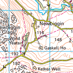
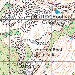
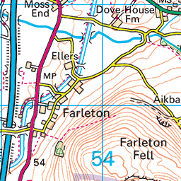
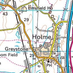
Even in the rain and mist though, this is a great walk – Hutton Roof is a favourite place to start a walk and is a location that we have used before. This time we start in the village centre and take a path up the edge of Hutton Roof Crags heading toward Newbiggin Crags, before heading back past Whin Yeats, and then taking quiet backroads to St John’s church, where we see the memorial stone for Bentham’s best known war hero.
- Total distance 6.3 km (3.9 miles)
- Total ascent 175 m
- Easy walk
Step-by-Step
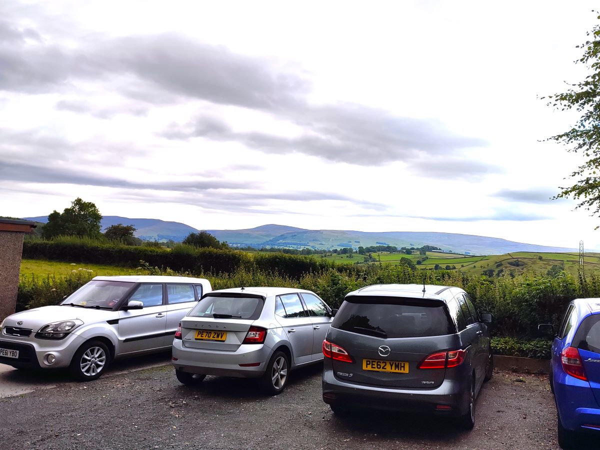
We start at the Village Hall in Hutton Roof – the postcode is LA6 2PG, but if you put that into your Satnav, you are likely to be directed on a route that includes very narrow lanes, where meeting an oncoming vehicle could be significantly problematic. So, if you want a safer route, take the A65 to Kirkby Lonsdale, then the B6254 to Whittington. At Whittington take the turn on the right signed for Hutton Roof and follow that road until you see a timber yard on your left. Take the next right and follow it into Hutton Roof. The Village Hall is out on the far side of the village on the right and is clearly signposted.
If you are using a paper map for navigation the OS grid reference is SD57017865, whilst the What-3-Words tag is door.spin.cured. Parking is paid for via an “honesty box”, so please give generously to help support this essential facility. If parking is not available there, try roadside parking near St John’s Church or in the centre of the village.
For more detail about the Vilage Hall and the rest of the village click visit the Hutton Roof village website
Having enjoyed the view from the Village Hall over Kirkby Lonsdale and on to Leck Fell, we head out of the car park and turn left to walk back down the road toward the centre of the village. We soon pass the Post Office on our right – but it would be very easy to miss this as the side of the building (Glebe Barn) that faces the road carries no signage other than a small and badly weathered post office sign. If you have a letter to post at the start of the walk, then access is via the road 50m further on.
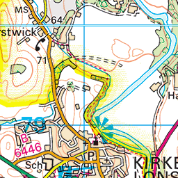
We continue into the village, and no more than 100m after the post office, we see a road junction. At this point we need to look right and take the lane up toward Hutton Roof Crags – this is signposted as a public footpath, but the sign (adjacent to the telegraph pole) is easy to miss.


We are now on a track that climbs steadily up the hill, passing a couple of houses, and eventually arriving at a gate that gives us access to the Crags.
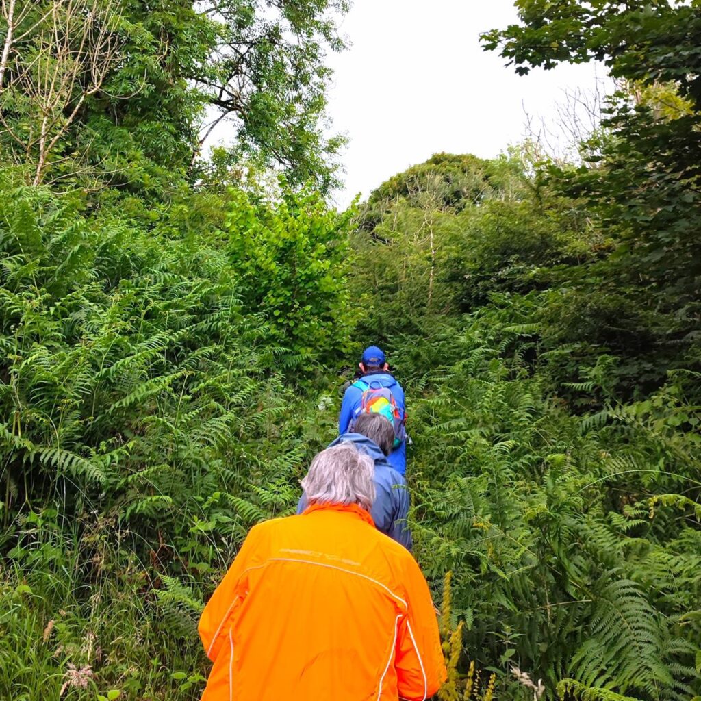
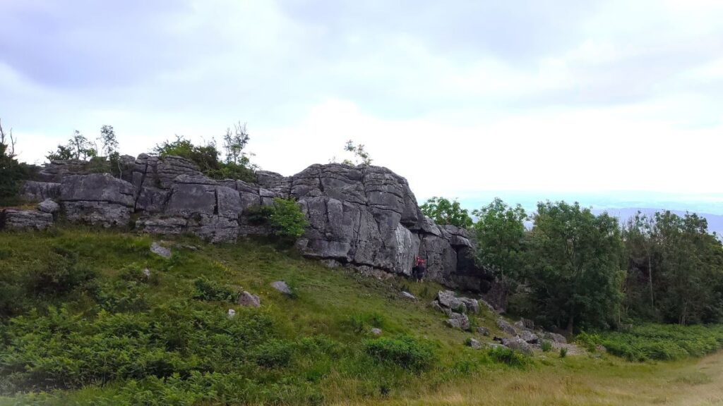
Hutton Roof Crags is contained within an area of open access land, so once past the gate, we could in principle walk wherever we want. In practice, dense bracken restricts us to a network of well-trodden routes that criss-cross some of the best limestone pavement to be found in the UK. The unique environment shelters a wealth of unusual plants and animals.
Much of the area is now a 245 hectare nature reserve managed by Cumbria Wildlife Trust and was created by combining parcels of land known as Lancelot Clark Storth and Burton Fell. The entire fell would once have been densely wooded, and so the current mosaic of woodland, scrub, grassland and heath results from past clearance and grazing. Walls were built to create enclosures in the 19th century, and only Park Wood and Pickles Wood have had continuous woodland cover since the medieval period.
Grazing intensity reduced in the 20th century, and this has allowed trees and scrub to re-establish, so the Crags are slowly reverting to a more natural state – a process that is assisted by active land management aimed at maintaining areas of open grassland and pavement. Cattle have a vital role to play in helping maintain the rich diversity of flowering plants.
Lancelot Clark Storth was purchased in 1978. Burton Fell was given to the Trust in 1992 by the New Zealand descendants of William Atkinson. Park Wood and Hutton Roof Common are leased from Natural England and Hutton Roof Parish Council respectively.
Visit the Cumbria Wildlife Trust website to find out more about the flora and fauna to be found in this special place.
Once on the open access land, navigation becomes problematic – not in the sense that there is any real risk of getting lost, but as there are so many paths to choose from, it is difficult to describe a route with any clarity. We therefore recommend that you follow the GPX if you want to keep to “our” route. If not have fun finding your own.
We initially head Northwest – this is the direction that the lane up from the village was heading, finding paths through rather dense bracken. After about 100m, we arrive at a fork, and stay left. It’s worth knowing though that the alternate path to the right goes to the back of St John’s church.


During the early stage of the walk, we are climbing consistently and at this stage the paths are generally quite easy.
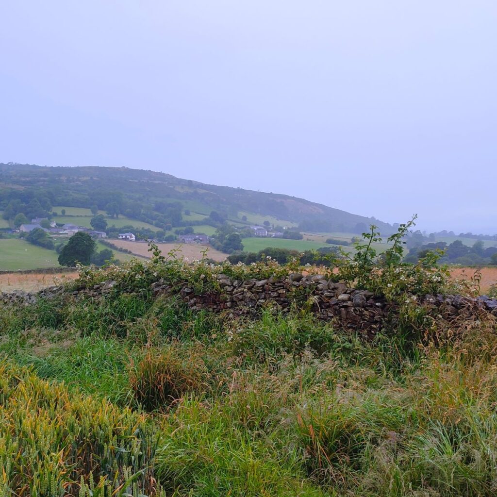
100m further on, the path comes round to the left, and we start to climb more steeply for a short while, before we reach a flatter section where we have a good chance of seeing rock climbers in the foreground with views over toward the coast beyond.
We were unlucky with the weather, so did not get the full view that can be seen in this facebook video
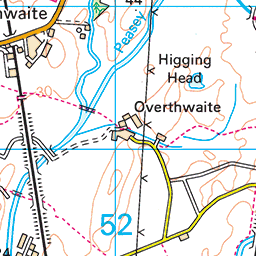
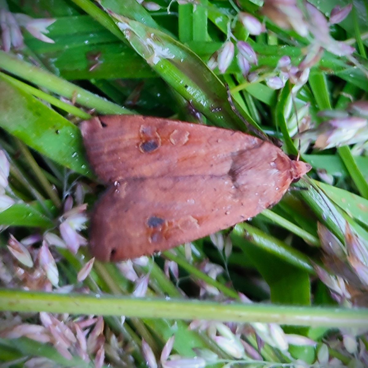
From here we head slightly right and climb again before the path levels out – from here we are much more obviously in an area of limestone pavement, so care is needed in wet weather. The path arcs round to the right and we are soon heading gently down hill again. As the descent starts, we have great views to our right, before we enter a wooded area where we have a good chance of seeing a variety of butterflies and moths, including on our visit what we believe to be a Lesser Yellow Underwing. As the name implies, this is well camouflaged when resting, only revealing the yellow / orange patches on the inner set of wings when in flight.

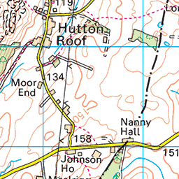
We soon arrive at a minor road which we access via a kissing gate. Here we head right and walk down the road passing the access road to Whin Yeats farm on our left – we don’t go to Whin Yeats farm on this occasion, but it’s worth noting that there is a public footpath down the access road that would take us down to Puddlemire Lane – so connecting this walk to our Holmepark Fell Walk is a possibility.
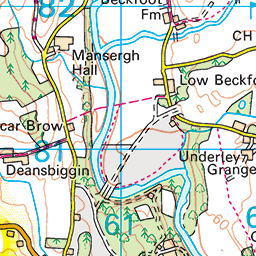
We carry on along the road for about 250m, until the road takes a sharp left turn. At this point we see a track carrying straight on, and we take that. The track heads slightly downhill, and then becomes a footpath along the edge of wheat fields before arriving at another minor road – Newbiggin Road. At this point we have a choice to make:
- We can go sharp right and take a somewhat overgrown green lane back to Hutton Roof – this is the shortest route and has the advantage that there is no road walking until we arrive back at the village.
- Or we can carry straight on and walk on the road to the next junction where we go right and back into Hutton roof.
We opted to take the road route – two sides of a triangle rather than the one of the green lane – we did this because the green lane is so overgrown that it is rather difficult to walk due to deep rutting and intrusive vegetation.
Both options come together just before St John’s church which is where we head next. Like so many of the more attractive churches in this area, it is the work of the Lancaster architects Austin and Paley – this one opening in 1881, as evidenced on the date weathervane.


In many ways the most notable thing about St Johns church is the fact that the vicar of the church between 1913 and 1918 was Rev. Theodore Bayley Hardy.
Hardy was born on October 20th, 1863, to George and Sarah Richards Hardy in Exeter before being educated at the Royal Commercial Travellers School, Pinner from 1872 to 1879, the City of London School from 1879 to 1882 and finally the University of London.
He was ordained in 1898. He was an Assistant Master at Nottingham High School where he taught D. H. Lawrence. From 1907 to 1913, Hardy was headmaster of Bentham Grammar School.
When the First World War started Hardy was the vicar at St Johns Hutton Roof, and volunteered to join the army as a non-combatant Temporary Chaplain to the Forces, 4th Class attached to 8th Battalion, The Lincolnshire Regiment. Not, it could be argued, the obvious route to status as a war hero.
However once in post his conspicuous valour in assisting and recovering wounded personnel earned him the Distinguished Service Order in 1917, the Military Cross (also 1917), and finally the Victoria Cross in 1918. He was wounded in action when again trying to tend to the wounded and died a week later in Rouen on October 18th, 1918, two days before his 55th birthday.
He was buried in France, with the memorial at Hutton Roof remembering him, and other locals killed during the Great War.
Click here for a wikipedia article about Hardy or here for a Baptist Times feature.
From the church, we walk a further 50m back to the village hall where the walk ends.
Our walks are rated according to distance and ascent – and this walk is categorised as “easy”. However, it crosses areas of limestone pavement which can be challenging in wet conditions – please be careful.