One of the benefits of living in Bentham is easy access to the Yorkshire Dales, the South Lakes, and the Forest of Bowland. That means great scenery – but at times, significant numbers of visitors. As this walk demonstrates though, think beyond the obvious honeypot locations, and it’s still easy to find a great walk which can be enjoyed in solitude, or with your favourite walking group.
From the easily accessed village of Rathmell, we head out on minor roads to Higher Lumb Gill Wood then stay on lanes to the oddly named Ragged Hall, before arriving at Whelpstone Lodge. From there we climb to the Trig point at Whelp Stone Crag – where we have our passports ready for a brief entry into Lancashire, before returning via Brayshaw, Boostagill and Cappleside. There are great views along the way, and because much of this route is on minor roads, the going is generally easy.
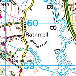
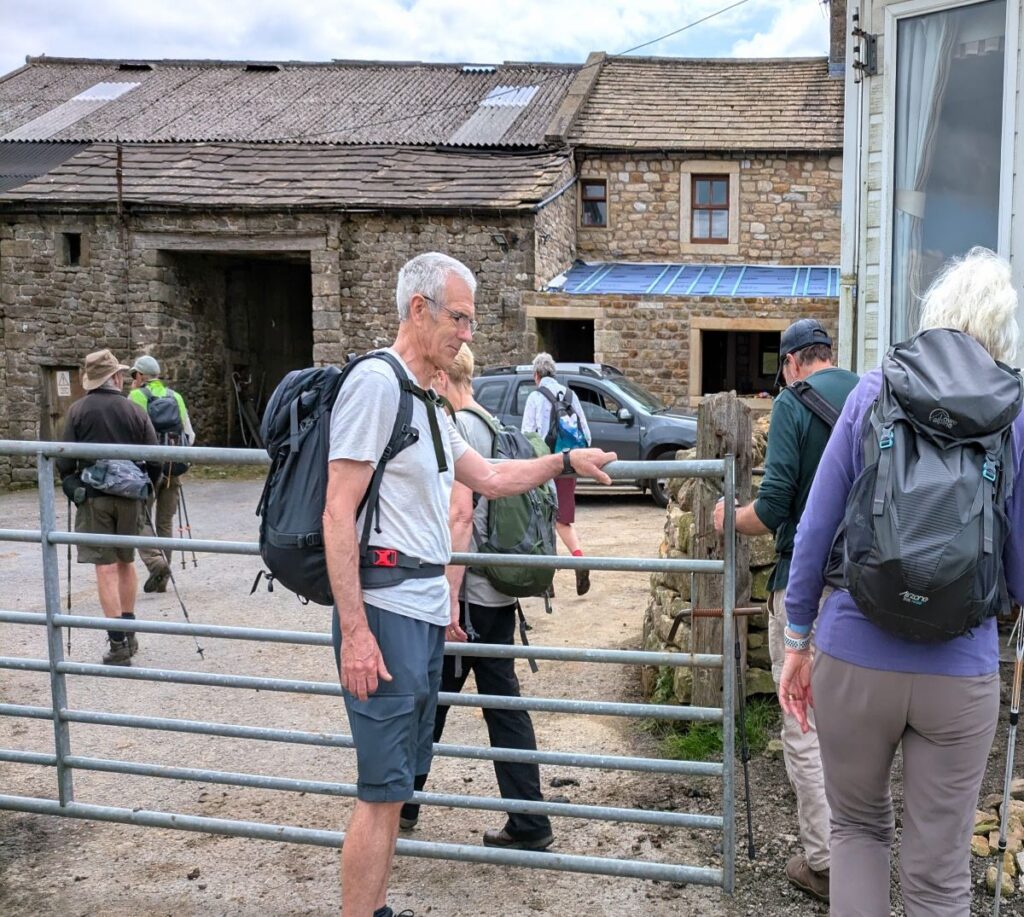
We start at the Village Hall car park in Rathmell. The best way to get to Rathmell is from the A65 – it is signposted on the “Settle by-pass” between the Settle roundabout and Giggleswick station. Follow the road from the A65 for just over a mile until you drive uphill into Rathmell – the car park is on the left almost as soon as you enter the village. If you are using a paper map to navigate, then the OS grid reference is SD80446003. If you prefer Satnav, then either Main Street Rathmell or BD24 0LE will work, as will the What-3-Words tag music.dividers.tinsel
From the car park, which offers great views over the Ribble valley flood plain toward Settle and Long Preston, and an interpretation board explaining recent changes to water management in the flood plain. Click here or here to find out more, or hereto see an animated interpretation of the changes
we head out onto Main Street and turn left heading toward the church. On the way we pass the wall mounted plaque remembering Richard Frankland, founder of the Dissenting Academy, initially based in Rathmell, but later relocating to Manchester and finally becoming Harris Manchester College Oxford.
Slightly further along we find the Rathmell Reading room – an important community resource for this small but active community – the population of Rathmell was just 305 persons in the 2011 census.
The name Rathmell incidentally is believed to come from Old Norse rauðr meaning ‘red’, and melr meaning ‘sandbank’. Rathmell, in common with a number of villages in this area, has a long history of Norse settlement.
To see a Wikipedia article about Rathmell, click here
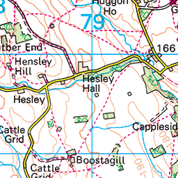
The Reading Room is on the junction of Main Street and Hesley Lane, and we go right to head down Hesley Lane for a while.
Our next significant landmark is the old school – Rathmell School was a typical village primary school with small classes, dedicated teachers delivering great results, and it seems, unusually good school dinners. A decline in numbers of children in the village led eventually to a decision by the School Governors and the community that it was no longer viable to keep the school open without sacrificing its high standards, and so the school was closed on 31st August 2017.
The school buildings were re-opened as a community and educational resource, and re-branded as Rathmell Old School. The current status is however unclear – there is a long running legal dispute between the Trustees of the Old School and the Anglican Diocese of Leeds regarding ownership. There was an out of court settlement reached in April 2024, where it was agreed that the fate of the site will now be decided by the Secretary of State for Education.
Just beyond the school there are well signed footpaths on both sides of the road – this is the Ribble Way which we will meet later – we ignore them for now though and continue up the road for a further 100m ignoring a small turn on the right, and then staying on Hesley Lane as it turns sharp right in front of Higher Lumb Gill Wood. The road then bears left, and again there are footpaths on both sides that we could consider for another day – the OS map indicates a waterfall on the left, and we do see a footbridge over the beck, so that might be worth exploring. Also worth noting along this stretch is the chance of seeing Alpacas – in the fields to the right of the road.
We stay with Hesley Lane for a further 300m – and arrive at Hesley Hall – a dairy farm, and then 200m later we arrive at a junction where we keep right, to be greeted by a Forest of Bowland sign.
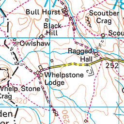
We continue on the road for a further 400m to arrive at the entrance to the curiously named Ragged Hall – and then 100m later we paused for a coffee break in the shelter of a drystone wall.
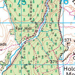
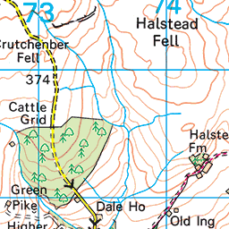
Pressing on, the road continues for a further 200m or so, eventually becoming a rough track at Whelpstone Lodge, an atmospheric derelict farmhouse that attracts both photographers and painters.
Ahead of us we see a gate, and from here we are on rough moorland for the final ascent to the trig point (371m) at Whelp Stone Crag. The path is clear on the ground, and as almost everyone walking here will take the opportunity to take in the views from the peak, the route is direct to the trig point. It is worth noting however that the path marked on the OS map stays south of the peak. Also of note here is that we have now strayed into Lancashire – the border is just 200m beyond Whelpstone Lodge.
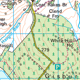
From the Crag, we have great views over Gisburn Forest although surprisingly Stocks Reservoir is not visible from here. There are paths down into the forest, where there are many further routes and trails to be explored. We don’t take that option today as it would extend our walk too far, so instead we turn round and retrace our route as far as the Lancashire border where we see the path fork – we go right and head toward the wind turbine we see in the far distance rather than returning to Whelpstone Lodge.
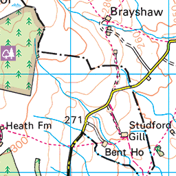
We are now walking over Holden Moor and heading toward Brayshaw – on the day of our walk, this was easy going, but reports on other sites indicate that this can be somewhat marshy after heavy rain. We soon arrive at the first of the three Brayshaws (we meet them in the order Higher, Middle, Lower).
The path takes us round the left hand side of a farm – this is Higher Brayshaw – before we bear slightly to the right, heading south toward Middle Brayshaw. The path to Middle Brayshaw takes us through a couple of large fields, crossing stiles, to arrive at the right hand end of a cluster of farm buildings.
Once we arrive at the access road to the farm we go right, and then after just 50m sharp left just after crossing Long Gill Brook, to the final Brayshaw – Lower.
At Lower Brayshaw we take the track at the left hand side of the farm. This goes behind the farm buildings and then heads southeast to meet a minor road after about 250m. Once at the road we head left, and before long re-cross Long Gill Beck. In fact, we see a footpath to our left now that goes over to Middle Brayshaw – which begs the question – why not take this path in the first instance? The answer is that the path was found to be too overgrown when the route was first explored. At other times of the year, it might be worth trying.
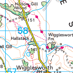
We stay on the road for a little while now, arriving at Long Gill, where we meet a junction. We go left here and walk north for 200m until we see an access track on the right leading to Peaks and Pods where we go right passing a wind turbine.
We follow the access road down to the site; it bears right and then as we approach the pods, we need to look for the stile on our left where the path heads to Cappleside. The route for the next 1000m is through fields – the paths are all at the field boundaries and at this time of the year when the grass is high, the route can be quite hard to see. Eventually, the fields give way to a wetter environment indicating that we are approaching a stream which we cross at a very attractive stone footbridge – at this point we are on the Ribble Way that we made reference to earlier in the walk.
Once over the bridge, we bear slightly left, where we see a farm track. We join this and go right to follow the track round the front of Layhead Farm – this is in effect a right turn onto Back Lane.
We follow Back Lane for 100m and then arrive at Main Street back in Rathmell. Here we turn left and walk past Holy Trinity church to get back to the car park.